G1000 NXi for the next generation of Piper M350 and M500 aircraft
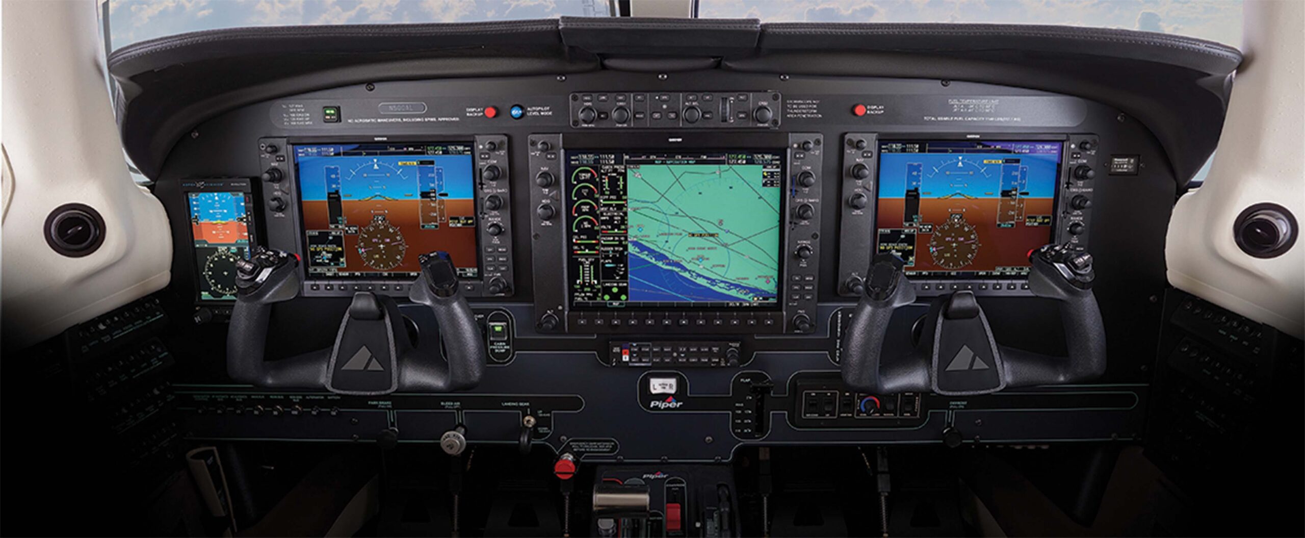
2018 models of Piper M350 and M500 feature Garmin’s new and improved G1000 NXi which incorporates innovative capabilities into a proven avionics platform with significant performance enhancements.
By incorporating modern processing power, the most noticeable improvement is faster map rendering, smoother panning and clearer, brighter displays. Valuable time is saved as the displays initialize within seconds after start-up, providing immediate access to frequencies, flight plan data and more.
Utilizing wireless cockpit technology unlocks even more capabilities. Flight Stream 510, available as an option, enables the wireless transfer of aviation databases from the Garmin Pilot app on a mobile device to the G1000 NXi system. It also supports two-way flight plan transfer, the sharing of traffic, weather, GPS information, back-up attitude information and more, between the G1000 NXi and compatible mobile devices running Garmin Pilot or ForeFlight mobile.
New map overlays within the HSI on the primary flight display enables the display of a variety of graphical elements while viewing other information on the multi-function display. NEXRAD, FIS-B weather, weather radar, SafeTaxi airport diagrams, traffic, terrain and more can be selected. For example, pilots can display NEXRAD radar and traffic on the HSI map while preparing flight plan information on the multi-function display.
Visual approaches have been integrated offering safety-enhancing guidance during visual flight conditions based on a three-degree glideslope from the threshold of the runway. Pilots can select the runway for which they have been cleared to land, set customized minimums, select vectors or straight-in for the final approach intercept and fly a visual approach coupled with the autopilot. This gives pilots a more stable and precise flight path throughout the approach and landing phases of flight in visual conditions.
One option to consider is SurfaceWatch runway monitoring. This technology aids in situation awareness while providing visual and aural cues to help prevent taking off and landing on a taxiway, on a runway that is too short or on the wrong runway based on performance data entered during preflight. Visual and audible runway distance remaining annunciations, which provides aural callouts beginning at 5,000 feet through 500 feet, are also available.
Equipped to meet future airspace modernization initiatives, the G1000 NXi system is rule-compliant with FAA ADS-B requirements. It also supports the display of various ADS-B In benefits, including traffic and subscription-free weather. Flight Information Service-Broadcast weather products include: NEXRAD, METARs, TAFs, PIREPs, winds and temperatures aloft, NOTAMs, AIRMETs and SIGMETs. Additional products provide pilots with target trajectories and closure rates, and/or a comprehensive picture of ADS-B-equipped aircraft and ground vehicles throughout the airport environment. These ADS-B In benefits combine to give pilots superior situational awareness tools throughout the terminal and enroute environments.
Additional G1000 NXi features:
- Advanced Doppler weather radar capabilities, including ground clutter suppression and turbulence detection as options.
- COMM frequency identification displays the station ID, as well as frequency type.
- Display of sectional charts, as well as IFR low/high enroute charts on the MFD.
- NEXRAD weather radar imagery can be overlaid on the moving map and animated on the MFD, as well as the HSI map.
- Vertical Situation Display (VSD) incorporates terrain profile view on the MFD, taking into consideration the active flight plan, altitude constraints and winds aloft.
- Pilots can preview departure and arrival procedures on the MFD prior to loading and activating the procedures.
- Three-color terrain shading incorporates green, yellow and red contouring, which depicts the aircraft is 2,000, 1,000 and 100 feet above ground level (AGL) respectively.
Note: Specific G1000 NXi information obtained from garmin.com